ARCGIS PRO - LOADING A WMS LAYER
Here is a quick walk-through on how to load a WMS layer in ArcGIS Pro, with some additional details on the DataBC services.
Learn more about WMS in ArcGIS Pro in the Esri documentation.
- Open ArcGIS Pro.
- On the ribbon’s Insert tab, click Connections > Server and select New WFS Server.
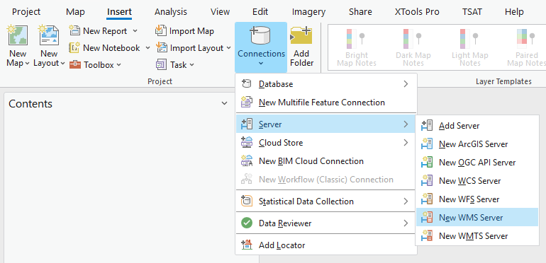
- Set the Server URL to
https://openmaps.gov.bc.ca/geo/ows?SERVICE=WMS&REQUEST=GetCapabilities, leaving the other settings as is.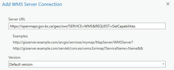
- Click OK.
-
In the Catalog pane, expand Servers and then continue to expand the new WMS connection,
DataBC Public Web Map Service on openmaps.gov.bc.ca.wms, and the groups within. Allow a moment for the layers list to load. You should see: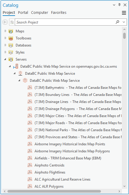
- Identify the dataset you’d like to add. Dataset names should correspond to the BC Data Catalogue. For this example, we will add Health Authority Boundaries.
- To reduce scrolling through the layer list, click one of the first layers, then type
hea, which should then jump to and selectHealth Authority Boundaries. Unfortunately, the search function does not include server layers. - Right click the layer name, and select Add to Current Map or Add to New > Map.
-
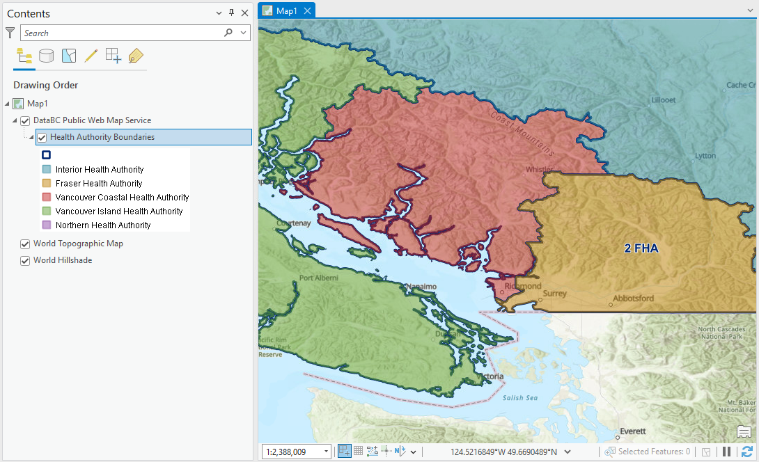
Explore the data - zoom in, pan around. Labels are visible for some services at pre-defined scales. If you expand the new layer in the Contents pane, you will see the layer legend.
WMS Styles
ArcGIS Pro adds the layer using the default style. Other style options can be accessed by clicking the layer name (
Health Authority Boundaries) in the Contents pane, then opening the WMS Sublayer tab and clicking Symbology in the Drawing group.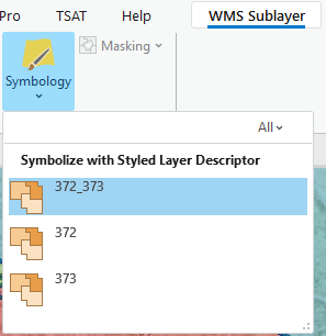
ArcGIS Pro only shows the style
Name, which is just an ID number. The layer specificGetCapabilitiesrequest (e.g. https://openmaps.gov.bc.ca/geo/pub/WHSE_ADMIN_BOUNDARIES.BCHA_HEALTH_AUTHORITY_BNDRY_SP/ows?service=WMS&request=GetCapabilities) shows theTitlefor each style. ForHealth Authority Boundaries,372(Outlined) shows only boundaries, while373(Colour_Themed) shows a coloured fill for each health area.372_373, the default, is a combination of both. A similar pattern is followed for most datasets. - DataBC’s WMS service supports
GetFeatureInforequests to view individual feature information. While this feature works just fine in QGIS, unfortunately ArcGIS Pro does not make the request correctly, so it is not possible to view any feature info beyond what is shown through symbology and labels.
Read more about the nature and limitations of WMS or jump into the WFS tutorial.