Running an analysis
After signing in you land on the setup page. An analysis has three parts: locate the proposed pumping well, choose its source aquifer, and set the pumping parameters. Then click Run Analysis.
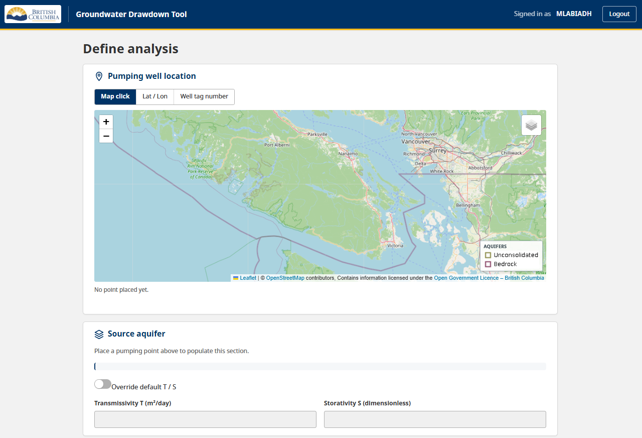
The top of the setup page: choose how to locate the pumping well, then place it on the map.
1. Locate the proposed pumping well
Choose one of three input methods:
- Click on the map — switch to map-click mode and click the proposed well location. The map cursor becomes a crosshair in this mode.
- Enter latitude / longitude — type WGS84 coordinates. The map flies to the point you entered.
- Search by well tag number (WTN) — look up an existing registered well by its tag number; the tool places the point at that well and resolves its aquifer automatically.
Map layers
The map offers several layers, chosen from the control in the top-right corner:
- Basemaps — OpenStreetMap (default), ESRI World Topographic, or ESRI World Imagery (satellite).
- Aquifers — the BCGW aquifer polygons, shown translucent (on by default).
- All BC wells — every registered well; appears once you zoom in.
- Water management districts and precincts — administrative boundaries with on-screen labels.
2. Choose the source aquifer
Once the pumping point is placed, the tool looks up the aquifer polygons at and near that location and lists them:
- Directly overlapping aquifers are listed first. If exactly one aquifer contains the point, it is selected automatically.
- Nearby aquifers — up to three within 1000 m — are listed below, tagged with their distance. This matters where a well sits just outside the aquifer it should really be associated with (common at re-delineated aquifer boundaries, or with stacked polygons).
- No mapped aquifer — if the point is not inside any aquifer, a “enter materials manually” option is offered.
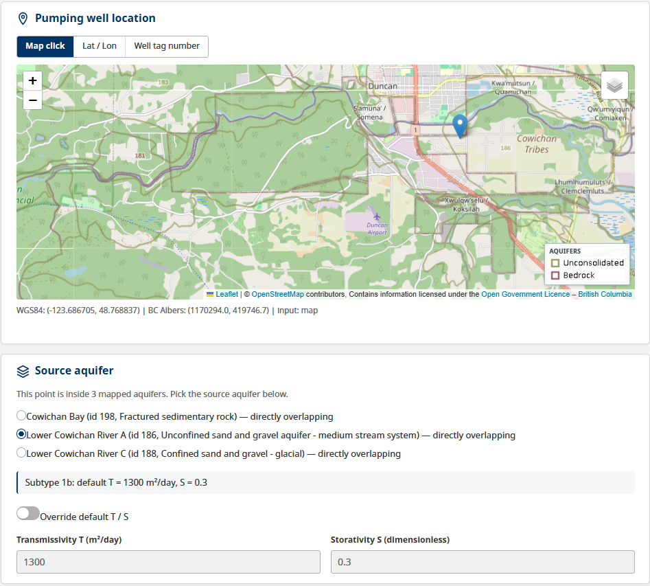
The source-aquifer picker after placing a pumping point.
Aquifer transmissivity (T) and storativity (S)
Once an aquifer is selected, the tool fills in transmissivity (T) and storativity (S) from a lookup table keyed to the aquifer’s subtype. These two values drive the drawdown calculation and are shown in a small panel directly under the picker, with the subtype that produced them.
To use your own values, tick Override default T / S and edit the T and S fields. The override applies to this run only; untick it to restore the lookup defaults for the selected aquifer.
T is transmissivity in m²/day; S is storativity (dimensionless). They describe how readily an aquifer transmits water and how much water it releases from storage — together they govern how the drawdown wave propagates outward from the pumping well. If the aquifer subtype has no reliable default (for example karstic limestone), the panel says so and you must enter T and S yourself.
Manual entry
If you choose the “no mapped aquifer” option (offered for points the Province has not mapped), the tool reveals a material dropdown — Unconsolidated or Bedrock — and the T and S fields become mandatory (there are no lookup defaults to fall back on). The same-aquifer filter is not available in manual mode. The results page shows an orange “manual entry” banner so the run is clearly marked.
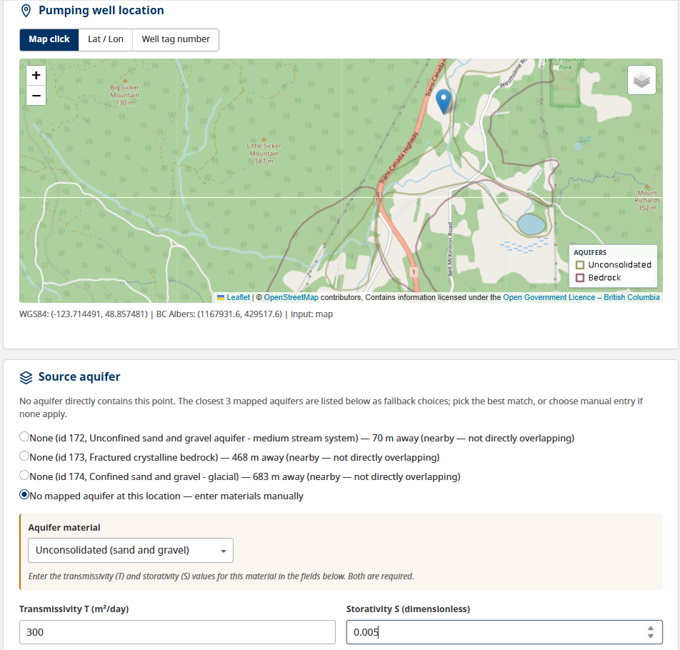
Manual-entry mode: material dropdown and required T / S inputs.
3. Set the pumping parameters
| Parameter | Notes |
|---|---|
| Pumping rate (Q) | A number plus a unit. Units: m³/d (default), m³/min, m³/s, m³/yr, L/min, L/s. |
| Pumping duration | In days. Default 90 days. Quick presets: 30 d, 90 d, 180 d, 1 year, 10 years. |
| Buffer radius | How far out to search for nearby wells. Default 1000 m. |
| Same-aquifer filter | Off by default. When on, the nearby-well list is narrowed to wells whose location falls inside the source aquifer polygon. Disabled in manual-entry mode. |
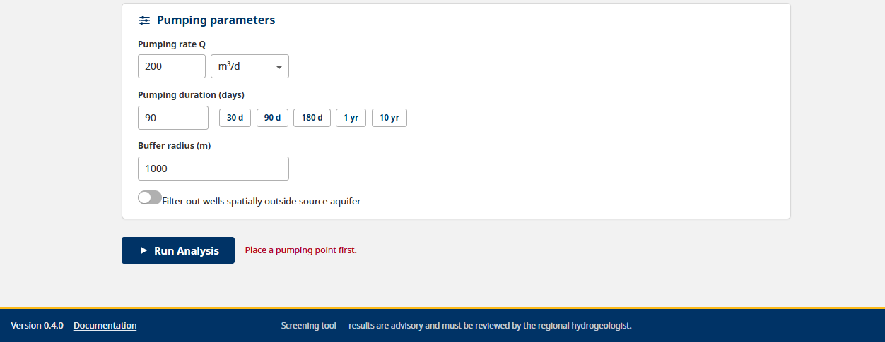
The pumping parameters panel: Q with its unit dropdown, duration with quick presets, buffer radius, and the same-aquifer filter toggle.
4. Run the analysis
Click Run Analysis. The tool validates your inputs, queries BCGW, and opens the results in a new browser tab. Your setup tab stays as it is, so you can adjust and re-run without losing an earlier results tab.
Continue to Reading the results.