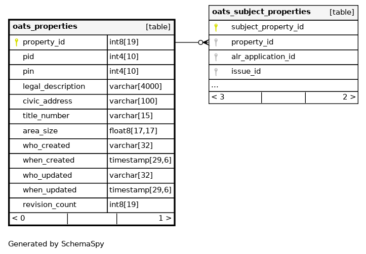
Columns
| Column | Type | Size | Nulls | Auto | Default | Children | Parents | Comments | |||
|---|---|---|---|---|---|---|---|---|---|---|---|
| property_id | int8 | 19 | null |
|
|
System generated sequence number to uniquely identify a PROPERTY |
|||||
| pid | int4 | 10 | √ | null |
|
|
Land Title Parcel identifier, displayed in the format 999-999-999 |
||||
| pin | int4 | 10 | √ | null |
|
|
The unique Parcel Identification Number for surveyed Crown parcels. |
||||
| legal_description | varchar | 4000 | √ | null |
|
|
The LEGAL DESCRIPTION uniquely defines a parcel of land typically based on its system of survey, but may include other references or even a metes and bounds narrative. The most common system of survey description consists of a hierarchy of parcel names and values (e.g. lot number, block number), primary land act parcel (e.g. District Lot), land district, registered survey plan, and possibly exceptions. |
||||
| civic_address | varchar | 100 | √ | null |
|
|
The free form civic address for the property where and when available |
||||
| title_number | varchar | 15 | √ | null |
|
|
The Land Titles assigned title number associated with a PID |
||||
| area_size | float8 | 17,17 | null |
|
|
The area of the PROPERTY |
|||||
| who_created | varchar | 32 | null |
|
|
WHO CREATED is the IDIR or Oracle userid of the person who created the record. |
|||||
| when_created | timestamp | 29,6 | null |
|
|
WHEN CREATED is the date/time that the record was created. |
|||||
| who_updated | varchar | 32 | √ | null |
|
|
WHO UPDATED is the IDIR or Oracle userid of the person who last updated the record. |
||||
| when_updated | timestamp | 29,6 | √ | null |
|
|
WHEN UPDATED is the date/time that the record was last updated. |
||||
| revision_count | int8 | 19 | 0 |
|
|
REVISION COUNT is used by Hibernate to control optimistic locking |
Indexes
| Constraint Name | Type | Sort | Column(s) |
|---|---|---|---|
| oats_properties_pkey | Primary key | Asc | property_id |
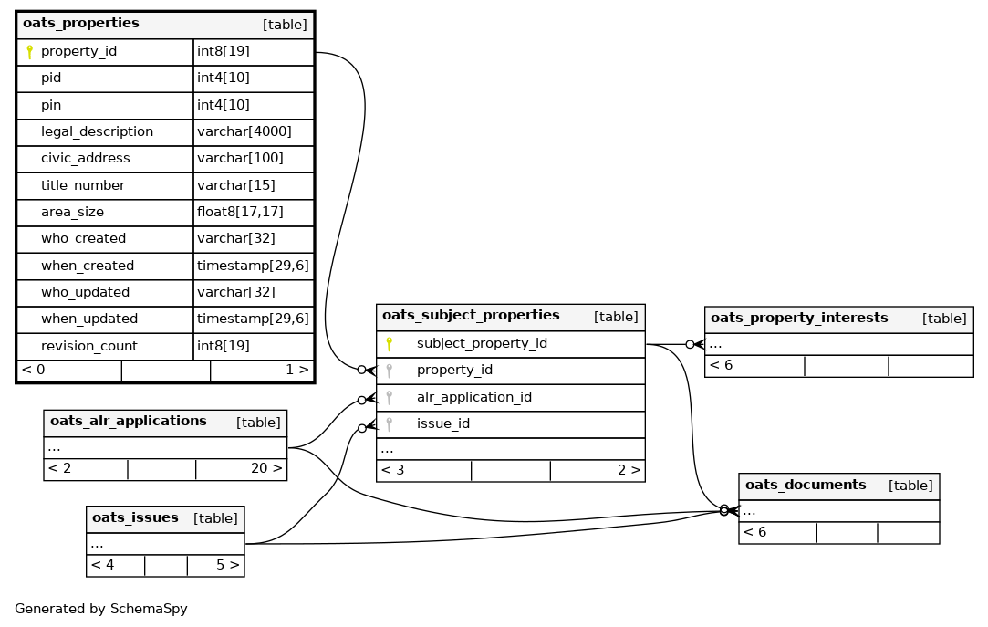
Relationships
Close relationships within degrees of separation